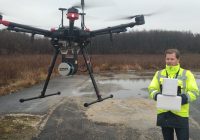
today announced that the YellowScan Surveyor from YellowScan has utilized Velodyne’s groundbreaking sensor technology to generate precise mapping data for an infrastructure construction project on one of Central Europe’s busiest roadways. YellowScan Surveyor, an unmanned aerial vehicle (UAV) surveying system, improves upon previous time-intensive manual surveying processes by providing a more efficient method for collecting landscape data with increased precision and detail. The project was conducted by Ventus-Tech using YellowScan Surveyor to collect data along…
Read Moresurveying drones
DJI M200 Series Drones For Aerial Data Collection
DJI, the world leader in unmanned aerial technology, has unveiled the new Matrice 200 drone series (M200), which is purpose-built for professional users to perform aerial inspections and collect data – making drone technology an affordable and easy-to-use tool for enterprises that recognise how aerial imaging can transform their operations. The M200 series’ folding body is easy to carry and easy to set up, with a weather- and water-resistant body, ideal for field operations. It…
Read More


