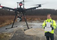
today announced that the YellowScan Surveyor from YellowScan has utilized Velodyne’s groundbreaking sensor technology to generate precise mapping data for an infrastructure construction project on one of Central Europe’s busiest roadways. YellowScan Surveyor, an unmanned aerial vehicle (UAV) surveying system, improves upon previous time-intensive manual surveying processes by providing a more efficient method for collecting landscape data with increased precision and detail. The project was conducted by Ventus-Tech using YellowScan Surveyor to collect data along…
Read MoreAerial mapping
ImiTec and Drone Ops Ltd announce UAV collaboration
Bristol based radiation mapping company, ImiTec Limited, and Newcastle based Drone Ops Limited, have announced a new collaboration for the provision of Small Unmanned Aerial Systems services. Droneops will be supporting ImiTec in the finals of the $1m United Arab Emirates’ Drone for Good competition which is being held in Dubai on 4 to 6 February 2016. ImiTec’s patented UAV based Advanced Autonomous Radiation Monitoring system can deliver low-altitude aerial meter resolution maps of radiation…
Read More


